As Canada’s leading cultural resource management firm, ASI is dedicated to, as our motto aptly states, “To best preserve our cultural heritage legacy in any planning and development context.”

To that end, we employ many tools from our toolbox that are not necessarily trowels and shovels.
The Burgoyne Bridge in St. Catharines, Ontario, is an example where our cultural heritage specialists were retained to establish the potential cultural heritage significance of a large piece of infrastructure and determine how any refurbishing, maintenance, upgrading plans may impact the structure to the point of hurting its cultural heritage value.
Most large cities in the province have a landmark bridge, one that has been there “forever”. In St. Kitts’ case it is the Burgoyne Bridge: a tall, slender, sleek high level bridge completed in 1915 spanning the 12 Mile Creek on the southern edge of the downtown core. The bridge is not only a familiar, reliable physical link between fragmented parts of town, but it is a link to the past as well. The bridge, and the land that anchors it, has witnessed much progress and change that helped make the Garden City the great community it is today.
History Revealed
The area surrounding the bridge, linked by the bridge, has had quite a history, before and after the bridge’s completion. It is literally in the heart of where St. Catharines (once called Shipman’s Corners) began. It is its birthplace. Today, a large portion of the historic 12 Mile Creek Valley is taken up by Highway 406. Most motorists passing under the bridge today are unaware of what activities once took there, the hustle and bustle of industry, ship building, the scent of malted hops and towpath horses in the air. It was a dynamic spot.
ASI Cultural Heritage specialists recently helped uncover the deep, rich past that lies in the shadow of the bridge. A past that
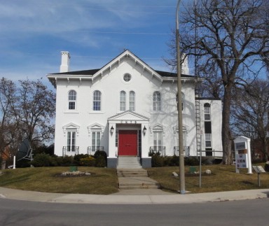
reflects the importance of the area over the centuries. The first church in St. Catharines (and cemetery) built in the late 1700s, existed till 1835 at its northern approach. Much of this land was owned by Welland Canal builder William Hamilton Merritt who owned a mill down on the banks of the river. His former residence, Oak Hill, rebuilt in 1860 after a fire, is also located here.
The area surrounding the bridge was a beehive of industrial activity for decades for one very special reason: The First Welland Canal used this portion of the Twelve Mile Creek, as did the Second Welland Canal, before hanging a hard left just past the present day bridge and journeying up towards the Niagara Escarpment, Thorold, Ontario, and beyond to Lake Erie. Multiple industries dating back to the 1830s dotted both banks.

The famous Maltese shipbuilder Lewis Shickluna had his shipyard in the shadow of the present day bridge. The famous brewery, Taylor & Bates, brewed its beer here. William Hamilton Merritt’s former residence is now the home of radio station CKTB whose call letters stand for for Cold Keg of Taylor and Bates.
American tourists flocked to the immediate area to bathe in the mineral springs that several hotels promoted for their guests’ comfort. The section of the canal here was home to two of the tallest concrete poles in the Commonwealth, used to carry telegraph wires over transiting ships. The Marx Brothers performed at the nearby hippodrome during the heyday of Vaudeville. Just downriver, at the Wellandvale Foundry, the pitchfork that a Scottish farmer used to capture notorious Nazi, Rudolph Hess, was made. The list goes on and on…
The Bridge Rises
The idea for a bridge spanning the entire valley was first discussed back in the 1880s. There was (and still is, but a later version circa 1940s) a small bridge that spanned the river but canal traffic and bad weather made it a very busy bridge and a dangerous one to navigate to in inclement conditions. To the west was Western Hill, a small community that felt isolated from the rest of St. Catharines, which was also the location of the area’s train station.

One century folded into another and by 1910, the idea was again considered with much heated debate. Finally, in 1915, at a cost of $160,000 ($4,500 under budget!), the bridge was completed, just as the Great War was beginning and steel was to become scarce. The bridge was named in honour of local politician/newspaper publisher and philanthropist, William Burgoyne and was designed by Sprague and Reppert of Pittsburgh. It was erected by Canadian Bridge Company of Walkerville, Ontario.
At the end of our exhaustive research and consideration, it was clear (and recommended) that the Burgoyne Bridge is a very significant and rare example of a “high level deck truss and slab on steel girder bridge, supported by steel bents on concrete pedestals.” The second oldest bridge in the area owned by the Niagara Region, it is considered to be an impressive technological and engineering achievement of its day that supports the historic character of the area through its age and association with the downtown core and historic neighbourhoods and should be preserved as such.
The Burgoyne Bridge. Not only is it a proud link to “the other side” but a link to our past. It spans not only a valley and a river, but 100 years of terrific history, reminding us of who we were, who we are today and where we are going, well into the 21st century.
Written By: Doug Todd

